How to Download Your Plot's FMB Sketch Online in Telangana
4 min read
Plot it buyer guide: July 2026

Fences move. Survey sketches don't. Every boundary dispute in Telangana starts with someone pointing at a wall and saying "idhi mee boundary." A fence is a claim. A sketch is a record.
Here's how to get yours.
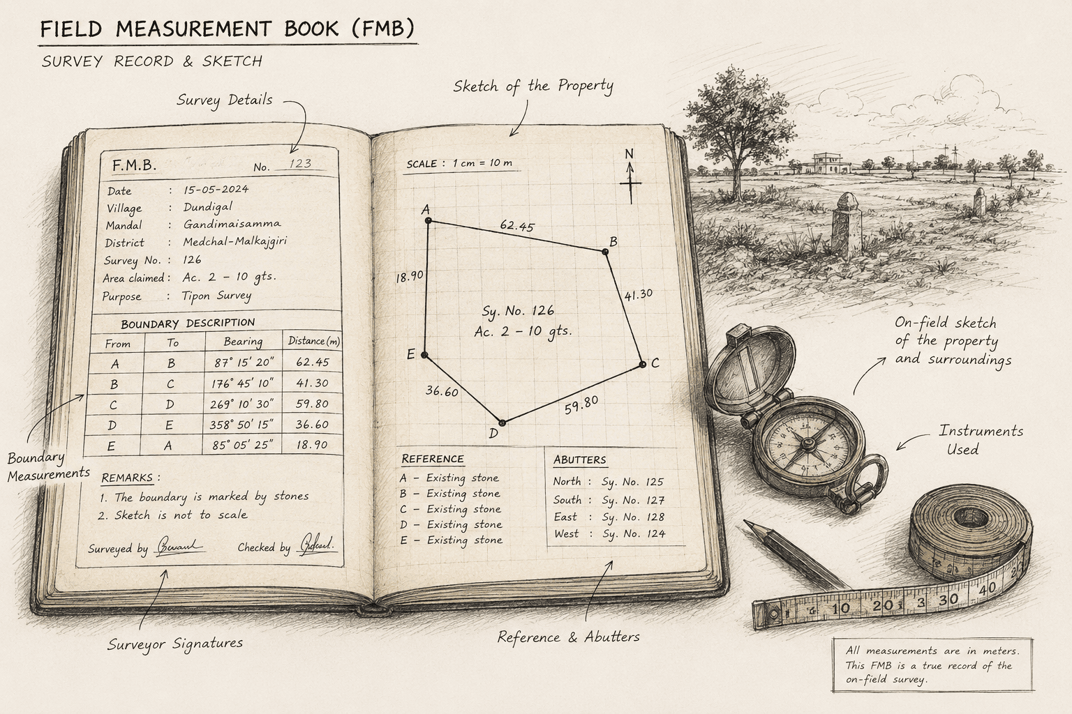
First: it's called a Tippan here
FMB (Field Measurement Book) is the national term. In Telangana the same document is the Tippan (or Tippon). Ask at the MRO for "FMB" and you may get a blank look.
This also explains why your online searches return mostly Tamil Nadu results. TN uses "FMB" and has an open download portal. Telangana's process is different — don't follow a TN guide.
The 2025 change nobody's talking about
Under the Bhu Bharati Act, 2025, every parcel now carries an LPM number (Land Parcel Map) — a drone-surveyed, geo-referenced ID that has replaced the survey number as the primary identifier.
In a boundary dispute, the GPS-mapped LPM boundary is now the primary reference. The Tahsildar refers to it over the old paper Tippan.
So the accurate rule in 2026 isn't "trust the sketch." It's:
Trust the geo-referenced map. Cross-check the paper Tippan. Investigate any gap.
A few guntas of difference is normal — drone measurement replaces old paper figures. A large difference needs an MRO visit and a correction application before you buy.

Method 1: Free map view (do this first)
bhubharati.telangana.gov.in/gis/ no login, instant, free.
Select District → Division → Mandal → Village
Enter your survey number
Your parcel highlights, with a Parcel Info panel
The trick that makes this powerful: open it on your phone while standing on the plot. Your GPS shows your live position on the cadastral map. You can see immediately whether you're inside or outside the surveyed boundary.
That single habit catches encroachments and mis-pointed plots before you've spent a rupee.
If it doesn't work: village missing → try Telugu spelling. Survey number missing → it was likely renumbered during re-survey; check the latest Pahani. Map blank → use Chrome on desktop.
Legacy option: dharani.telangana.gov.in/gis still works for boundary viewing. Use it as a cross-check only — for ownership, always Bhu Bharati.
Method 2: Certified Tippan via MeeSeva
A GIS screenshot is not a legal document. For registration, loans or court, you need the digitally signed sketch.
Go to
meeseva.telangana.gov.in(or any MeeSeva centre)Land Records → Survey Sketch (Tippon)
Enter District → Mandal → Village → Survey Number
Pay the fee, download the signed copy
Usually same-day or next-day for digitised parcels. Non-digitised records route through the MRO and take longer — carry pattadar passbook, sale deed and Aadhaar if you're applying in person.
Then tie it to the ground
Get a licensed surveyor to run a DGPS or total-station survey mapping the sketch points to real coordinates.
You get corner coordinates that can be re-established anytime, documented proof of the boundary on your purchase date, and immediate detection of any shortfall in extent.
Do this before registration. After registration, a shortfall is your problem to litigate. Before, it's a reason to renegotiate or walk.

Red flags
What you find | What it means |
|---|---|
Survey number returns nothing on GIS | Renumbered, or moved to Part-B (disputed) — stop and investigate |
Record sits in Part-B | Overlapping claims; access restricted deliberately |
Large gap between sketch and drone extent | Needs MRO correction, not a seller's explanation |
Ground markers don't match the sketch | Encroachment, or wrong parcel |
Seller won't allow a surveyor on site | The strongest red flag on this list |
What the Tippan won't tell you
It answers where and how much — not who or can I build. Ownership is the ROR/Pahani. Loans are the EC. Prohibited status is the 22-A search. Approval is HMDA/DTCP. Each is separate.
A perfect sketch on defective title is a beautifully drawn map of a problem.
Bottom line
A broker's stone marker is an opinion. A drone-validated boundary tied to coordinates is a fact.
Check the map before you visit. Get the certified sketch before you pay. Get the survey before you register.
Boundary clear ga lekapothe, entha cheap ga ostunna aa plot konakandi.
Telangana land procedures have changed substantially since April 2025 and continue to be refined. Verify current process with the MRO or a property lawyer before acting on a specific parcel.
Stay in touch
Stay updated with the latest news and insights from Plot It.